http://152.31.99.8/
Well you know things aren't going to go well when you're using Firefox and you get the following message:
 It doesn't tell me what browsers are supported, just says that my
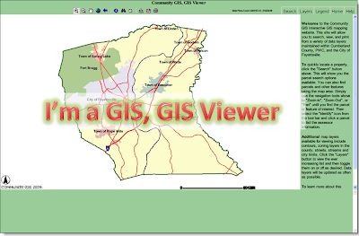
 From a functional standpoint, this site works. It does what it is supposed to do - display GIS data. Does it add anything vs. the standard ArcIMS Viewers that are a dime-a-dozen?!? Nope, sorry. When the parents ask "How'd Johnny do on his assignment?", if the teacher replies "well, he handed it in"... you can read between the lines.
Search tools are pretty standard - searching by Parcel / Owner / Address / Street Name either take you to the place on the map, or punts you to another website with joined information (Owner info for example).
Marks for:
- Dynamic legend - changes with what you have in the map
- Help is there - which is always important and they get marks for that - State Plane Coordinate display
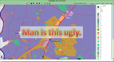
- Standard colors are average (except for their Zoning layer - see below for example)
- Dynamic layer control - turn something on - it turns on. Turn it off? You guessed it.
Marks against:
- Scale bar is hard to read in their bold font
- No halo text around some features make them difficult to read when the aerial image is turned on
- No mention of downloading data - No mention of metadata
- Displaying database column headings in query results - the average person doesn't care to see "ST_NAME" or "ST_NAME_ID" in a query result. - The standard ArcIMS info tool isn't intuitive - if I want to select a parcel but my active layer is the streets layer, there should be a drilldown option so that all visible layers are presented. I don't want to have to keep going back to Layers / Active then Info every time I want to do a select query. This is because they haven't done anything outside the standard features of the ESRI ArcIMS HTML Viewer.
- So good they named it twice "Community GIS, GIS Viewer"

This map? Not so pretty.
 Overall Grade:
C
(very average, a passing grade, but hasn't done anything extra to impress)


No comments:
Post a Comment